
Strong networks and public safety
A strong network can support the public services that help us feel safe at home and in our communities.
Improved information sharing, location accuracy, and connectivity help make communities safer, supporting:
- 911 service, emergency and
first responders - AMBER and Silver alerts
- Natural and man-made disaster alerts
- Communication apps during and after
disasters - Reverse 911 alerts
Mobile connectivity and Enhanced 911 service
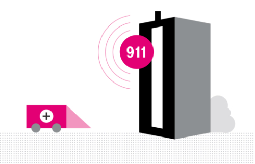
Mobile connectivity can serve as a lifeline between first responders and people in distress in the event of an emergency, a natural or man-made disaster, or a threat to the community.
Enhanced 911 systems (E911) provide dispatchers with the location data they need to find wireless callers who need help.
Wireless subscribers also receive Reverse 911 and Emergency Alerts—text or voice messages sent to subscribers in a specific area affected by a local or regional emergency.
Enhanced 911 location accuracy
The Federal Communications Commission (FCC) requires wireless providers to relay location data to dispatchers on live 911 calls. The accuracy of that data varies; determined by signal strength, mobile device model, and whether GPS is enabled.
As we strengthen T-Mobile networks across the US, we are actively improving location accuracy for everyone.
Horizontal accuracy
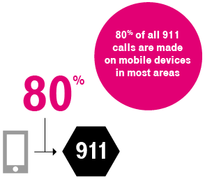
In 2015, the FCC defined milestones for horizontal accuracy improvement – requiring horizontal location accuracy to be within 50m (162 ft) for 80% of mobile 911 calls by April 2021. T-Mobile met, and exceeded this milestone well ahead of the schedule.

Vertical accuracy
When an emergency call is placed in a high-rise building, dispatchers need to know which floor to send responders to. We are continually working with the FCC and developing the technology to meet the most up-to-date requirements.
Personal and public safety beyond 911
In emergencies, wireless connectivity can sometimes be a matter of life or death.
Messaging apps, social media, and geolocation
TExt reconnects family after disaster
A Georgia man was trekking through Nepal when a massive earthquake ravaged the country. He was able to text his wife to tell her that he and his guide were okay shortly after the disaster struck.
Source: The Atlanta Journal ConstitutionInjured biker tweets for help
Lost and unable to walk after hitting tree roots and flying over their handlebars, an injured biker didn’t have a strong enough signal to dial out but tweeted: “I’ve had a serious injury and NEED Help!” At least six people called 911, and within minutes ambulances were dispatched.
Source: Mother Nature NetworkGPS saves heart attack victim
Air Idaho Rescue pilots were able to pinpoint the location of a local hunter in crisis at 7,200 feet using his cell phone GPS. The heart attack victim phoned Air Idaho himself and was located, retrieved, and transported to East Idaho Regional Medical Center within 17 minutes of the call.
Source: KOMO NewsEmergency alerts

AMBER ALERTS
Help law enforcement search for and locate a missing child

silver alerts
Help law enforcement search for missing persons with cognitive impairment—especially seniors with dementia or Alzheimer’s disease

imminent threat alerts
Mobilize the community in a natural or man-made emergency